

 This is a Grand Canyon adventure that begins way outside the park boundaries on Navajo territory in Arizona. It’s difficult enough to find this route to the Little Colorado River, but even harder to complete this trek to the confluence with the Colorado River in the Grand Canyon, especially when the river is running high with muddy water like it was for us September 21-24, 2012.
Bushwhacking to the confluence involves a serious desire along with patience, perseverance, and a couple tricky, potentially dangerous river crossings, depending on the current, which was pretty fast in parts.
The good news is that we now have a new road and clear directions to the trailhead. This is the first time these directions have been updated online since 1991, as far as I can tell. Without these directions, we wandered around for 3+ hours before we found the right road to the trailhead. On the way out, though, we followed some USGS workers we met at the bottom and they showed us the super-fast way.
►See all the photos of this trip on Facebook
 So, here’s how you get to the Salt Trail, down to the Little Colorado River, and then to the confluence with the Colorado River in the Grand Canyon.
Driving north from Cameron, Arizona and the junctions of US 89 and 64, turn left between mile marker 486 and 487, onto Navajo Road 6133. Then, set your odometer to zero and drive 12.5 miles.
You’ll know you’re on the right road, about 5-6 miles in when you see a big pile of neatly painted, stacked, silver tires with a metallic horse statue sticking out of the top to mark a ranch entrance. This is just a point of reference, so don’t turn there.
 At around 12 miles, start looking for a Navajo compound with a house, trailer and other buildings off the main road to the right. Shortly after this driveway, spot a road marked by 2 big rock cairns on each side of your current main road, 6133. Turn left towards the southeast on this road that we think is 6130, but it's not marked with a sign at this junction, only cairns. Follow this road about 5-6 miles until it pretty much comes to an end, then bear left and see a big rock cairn on the top of a hill. Drive down to the parking area and look for the drainage below to the west.
From the parking area, you can follow a slight path down the drainage to the Gorge. You’ll know you’re at the right Gorge entrance when you see the 2 large cairns marking the gateway to your plunge. Say hi to Horatio the Lizard, guardian of the entrance. He may ask your 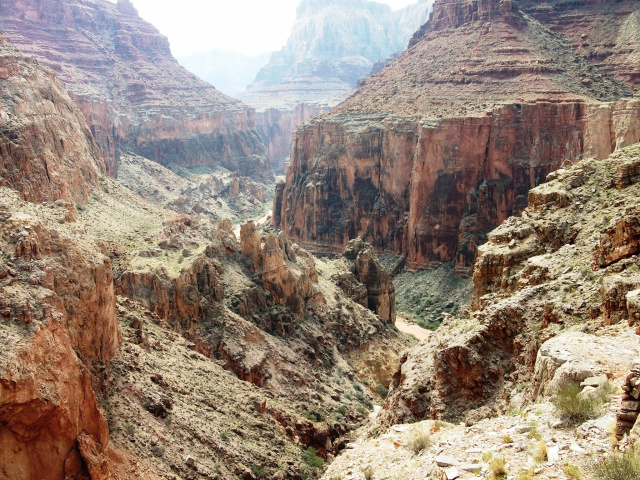 favorite color. Be sure to answer correctly, “Red…uh, no, I mean blue” (vague Monty Python reference).
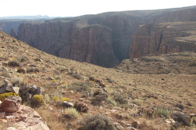
Heading down the Gorge toward the Little Colorado River, be prepared for a long, tough, toe pounding descent. It took us about 5 hours to reach the bottom at a slow, deliberate pace. Our feet were aching, especially from our toes pounding into the top of our boots. This route is slow going almost all the way as you really have to pick each step carefully, avoiding a tragic fall while following the rock cairns that mark the route. This is not a trail. If you go 100 yards or more without seeing a cairn, you’re probably in the wrong spot. It’s easy to get confused, but better to backtrack to safety than plow ahead incorrectly.
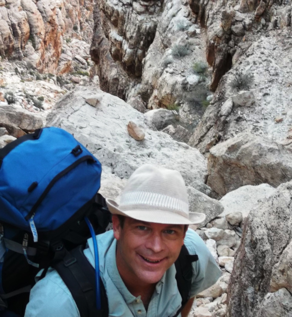 The initial descent is steep, exposed, and requires sure footing on very unstable rocks. The first half follows along the east side of the gorge, through the redwall, then, crosses over to the west for the rest of the way. The crossover takes a long time as the jumble of boulders makes route finding more difficult and the fallen cairns don’t help. We stacked a few of the rock piles back into place for those that would pass this way later.
There’s a split in the trail at one of the tough crossing points. On the way down, we were able to stay right here, which was much less frightening than the split to the left, steep down toward the edge of a big drop-off into Buckihatso Wash. On the way up, our USGS friends took this other, much more difficult route, while the moderate split was easier and faster. So, staying toward the high side was the right choice here, unless you need extra challenges. More about our USGS friends, later.
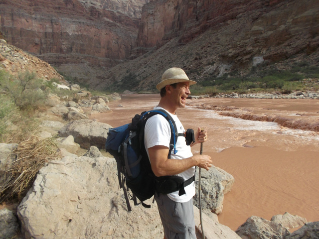
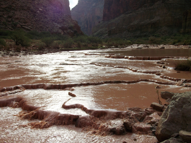 Once you’re on the west side of the wash and looking at the Little Colorado River, you’ll still have a tough descent into the bottom. Take your time, drink plenty of water, and hope that you're blessed with the blue water flowing casually down from Blue Springs 7.5 miles upriver. For us, it was a muddy weekend of wading, swimming, washing, and drinking out of Willie Wonka’s Chocolate River.
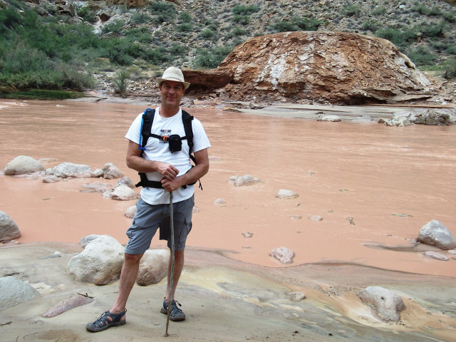
Once we arrived at the bottom, we met some very friendly and accommodating scientists from the Unites States Geologic Survey. The scientists of the USGS study our environment, the natural resources, and the vulnerabilities that pose threats to them. This group, led by Flagstaff USGS scientist Ted Kennedy (no joke, that’s his name), was testing water and tissue samples, cataloging various species and working in the muddy water for 4 days.
 Our USGS friends immediately shared their lunch buffet of cold cuts and sandwiches that were the finest we could ever expect in such a place. Best of all, they loaded us up with all the water we could carry. It was enough to stay hydrated another day without having to pump the brown sludge through our water filters. Later, I did pump one quart from the LCR, but it eventually clogged my filter. Also, the water in this area is very minerally tasting, so even in the best of seasons it is not very good to drink. There are springs that feed into the river banks along the way, but they’re just as bad with a flavor that might best be described as milky, sulfur, salt-water. Also, without filtering, diarrhea is a common side effect of drinking this water.
 The fresh water from our USGS friends, along with most of their supplies, had been flown in via helicopter. There’s a helipad right at the bottom of the Salt Trail by a spring that feeds into the river. Several people camped on the pad while another group stayed in the trees next to the river. They mentioned a rattlesnake that appeared every night to hang out in the campsite, and bark scorpions on the trees. “Don’t lean against the trees at night, they warned”, as the bark scorpions have one of the nastiest stings around. The other information they shared was that a group tried to bushwhack downriver toward the confluence, but quickly gave up and returned to their camp by the helipad. This was bad news for us.
 Our challenge was to navigate 6 miles down the Little Colorado River to where this warm, muddy milk would join the frigid, green waters of the Colorado River.
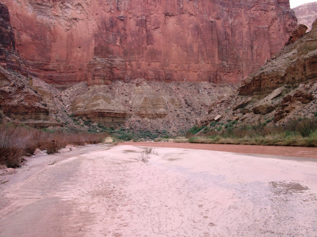
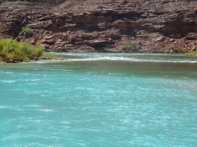
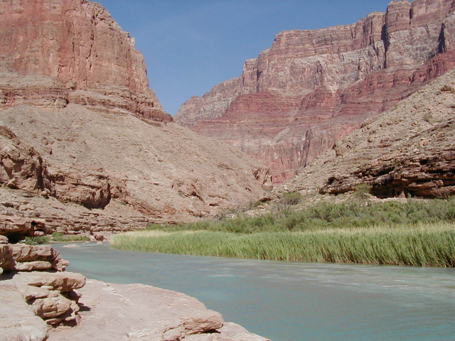
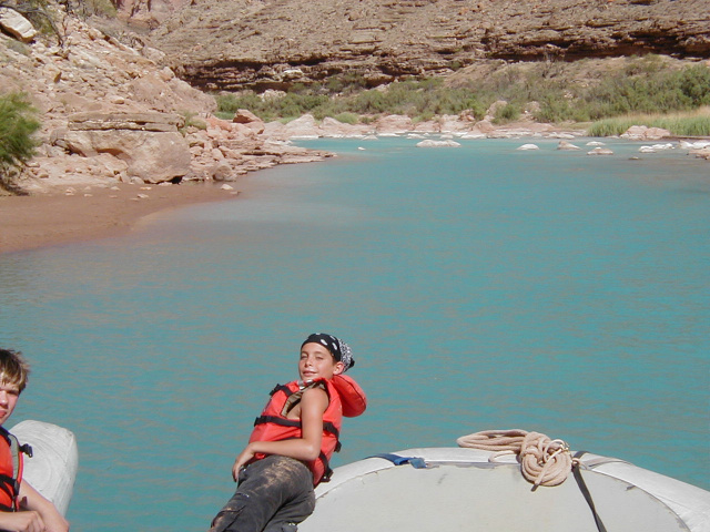
The mouth of the LCR is known as “The Confluence”. It’s also where Marble Canyon officially becomes the Grand Canyon. It typically takes 3-5 days to raft to this point from Lee’s Ferry on any Grand Canyon rafting trip. Most trips will plan a stop here, especially if the water coming out of the LCR is blue instead 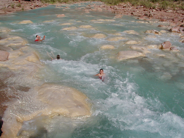 of brown. The spectacle of these 2 rivers coming together is one of the most impressive sights in the Canyon, no matter what color the water.
When it is good for swimming, though, it’s great to sit on your life jacket and roll down the rapids of the LCR, just a short distance up from the confluence. I had been here on a rafting trip 8 years prior, but now I knew how hard it was to hike to this point.
 The problem we faced was that the river was too high, too muddy, and too swift to float, wade, or swim down. Plus, getting back upstream would have been impossible. At this point, we thought our trip was going to be cut short, so we searched for a campsite upstream along the banks. After losing our shoes in quicksand and having to help each other out of this sinking sludge every few feet, we spotted a nice, flat soft beach, but unfortunately it was on the other side of the river. Oh well, it looked like a reasonable place to cross, so we were just about to go for it. That’s when Ted Kennedy came hollering after us that someone just showed up in camp who had hiked from the confluence that day.
We immediately 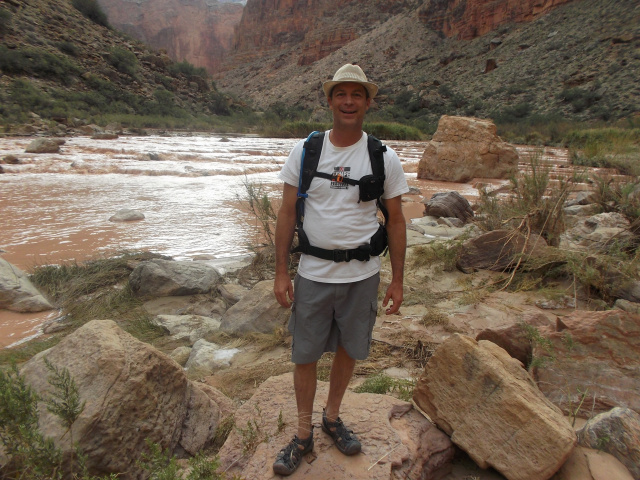 high-tailed it back to the camp where our newfound guide explained how he navigated the banks and 2 river crossings to arrive here in about 3.5 hours from the confluence. That was all we needed to hear and we were on our way downriver. Before we set out, this savior of our trip (didn’t even get his name) told us about a great camp site about a mile downriver where we could crash in comfort and set out for the confluence the next day. We were already exhausted from the 5 hour plunge down the Salt Trail, so this last mile was about all we could hope to squeeze in on our fist day. Plus, we knew the bushwhack downriver would seem like a really long mile that would end with our first river crossing to reach the campsite.
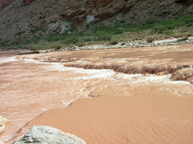
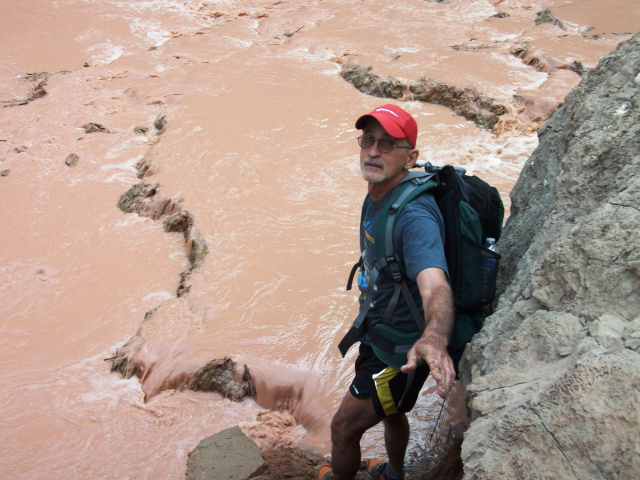
This relatively short distance would have been really nice when the river 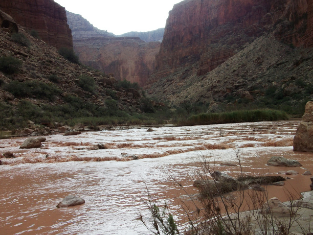 was blue, clear and flowing smoothly, but not this day. In fact, our river guide told us that just a couple weeks prior, this area had seen the highest water in 60 years, flowing at 8000 CFS, 30 feet up the banks where we were now standing in mud of every color, texture and density. Some of the mud you could walk on, but some of it would immediately pull you in and if you stood there long enough would be up to your waist in a few minutes. Whenever you stepped into the river, there was a chance of either sinking deeply or hitting some very sharp rocks that could not be seen through the chocolate. Sticks were helpful, but the current was swift enough to knock you right off your feet.
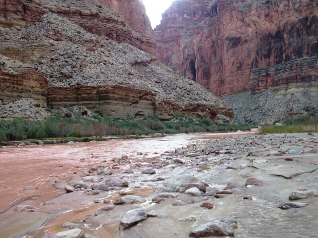
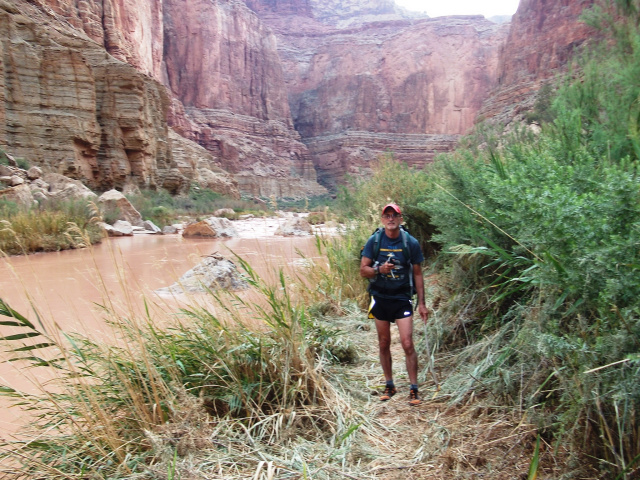 So, the best routes were through the tall reeds growing along the river banks. Fortunately, Arizona Game and Fish employees had been through there with machetes and cleared narrow paths through the reeds. Otherwise, walking along the banks would have been nearly impossible. The first mile of this was the worst, as our guide had mentioned. My partner fell in the river at one point, soaking his pack before we even tried to cross. He thought he was going to take a simple step down into the water and back up onto the other bank, but hit one of those sinking holes and fell right in. I was in no position to help as he extricated himself and I held tight to the muddy bank while attempting not to emulate him.
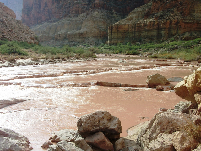 After slashing through sharp grasses and trees, we finally reached a place where we had to cross the LCR. We picked a route that was along the top of the sharp, travertine dam, rather than below the dam where we couldn’t estimate the depth of the water. We knew this would be tricky with the rocks, but it was better than sinking in mud. Using our sticks to poke and prod the rocks ahead of us, we slowly picked our way across at a snail’s pace. Once we hit that other side, our lives improved dramatically. It was just a few yards to a most perfect camp site under a rock ledge with soft sand and a beach between us and the river. The only downside was the critters we would battle that night.
After settling in to camp we dined and crashed. Too bad 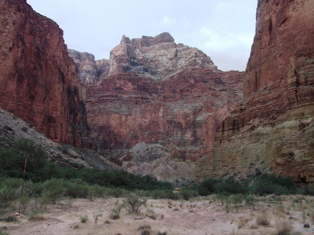 that we made the mistake of leaving our food exposed. About midnight, a ring tail cat (they’re all over the place at the Grand Canyon) knocked an apple on the ground and woke us. That noise probably saved all of our food from being consumed before dawn. Our flashlights blasted light all around the campsite and we quickly spotted 2 cute little cats, eyes gleaming in the light and their long tails dancing in the shadows. We gathered up our food, assessed the damage (just a few nuts and a power bar lost), and went back to sleep with what we thought was a better hiding job. I sealed my food tightly in a garbage bag with my clothes and used it as a pillow.
Shortly before dawn, I awoke to the sound of a s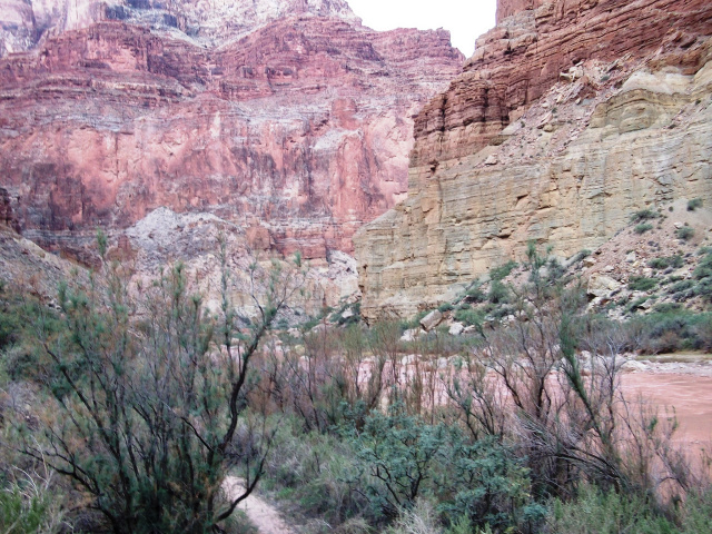 quirrel in the garbage bag by my head, rattling crackers, cookies and other contents. I scared him away, but he just kept coming back. We didn’t get much sleep that night, but we decided to hang everything with ropes the next night and were never bothered again.
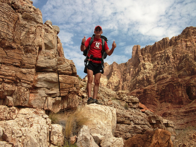
The following morning, we left all the heavy stuff in camp and just took food and water in our packs for the trip to the confluence and back. This was to be a long day filled with fantastic moments plus some route finding and river crossing challenges that would make anyone nervous. Our round trip would be about 10 miles and take us 4 hours each way. Plus, we would enjoy a long lunch at the Confluence.
 Our first destination was the Sipipu, a sacred Hopi Indian site that is believed to be the doorway for spirits from the dead. It’s really a non-descript mound of minerals and dirt with a spring flowing out of it. We wondered how the Hopis identified this site as something special, but knew not to disturb it. We took pictures from the other side of the river. It was not a good place to cross, anyway, so no point in getting closer.
From there, we knew it was 4 miles to the confluence with a good trail on the left bank. We also knew that the left bank would not last and that we would have to cross the river again, but had no idea where this crossing might best be made.
 Finally, the left bank ran out of good paths, so we had to cross the muddy water again. This time we tried to pick a similar route along the top of the travertine dams. Unfortunately, the current was stronger, especially in the middle, and it knocked me off my feet. Fortunately, my buddy was behind me, and he was a Vietnam vet , so his instincts kicked in and he was able stop me from flowing down the rapids. With his help, it was possible to right myself and felt extremely grateful that he was able to keep from being pulled downstream, too.
We made it across the river slowly and carefully without incident after that, but quickly realized both of our digital cameras got wet. No more pictures from there on, but at least our memory cards were ok. I have included some photos here of the confluence when the water was blue on my previous trip.
We ran into another USGS crew about a mile up from the confluence. They offered me a warm banquet beer left behind by another group and suggested I cool it in the 44 degree Colorado River water at the Confluence for about 6 minutes to get it perfectly frigid.
From their camp it was a 20 minute hop, skip and jump to our final destination! And, oh, was it worth the trip. We arrived on the big beach at the mouth of the Little Colorado River just as one rafting crew was pulling out on Day 5 of their paddle trip down the Colorado River in the Grand Canyon. We enjoyed the beach by ourselves, loaded up our bottles with cool water and chilled the beer.
 After lunch, we were just about to start our journey back to camp when another rafting trip came by with more beer, and it was cold this time. Lucky for me, my friend didn’t drink, so the sweet, cold suds were all mine. As thirsty as I had been for two days, and so far from a refrigerator, you can bet that beer was extremely refreshing. We admired the impressive view at the Confluence then headed back to camp 5 miles up the Little Colorado River.
On the way back to camp, we stayed on the left bank too long and missed our good crossing points. The path gradually ended as we searched for a safe place to forge the river. It was not looking good as the current here was swift and depths were hard to judge. We foolishly continued to bushwhack our way through trees and bushes that were scraping us like barbed wire.
After about 20 minutes of slashing our way up and down the riverside looking for a place to cross, we finally went for it in a spot that could have been 2 feet deep or 20, but at least the current wasn’t death defying here. It actually turned out to be a good crossing point, but we sure wished we had found it a few minutes earlier. Our legs and arms were now covered in scratches and lesions that made us look like flogging victims.
Eventually, we made it back to camp, exhausted, humiliated by the bushwhack, and ready for a chocolate milk bath. We both agreed that the river looked muddy, but still was making us clean. At least one layer of silt had been removed, but a couple showers would be required to get rid of the rest of the muck.
 We still had one more arduous day ahead of us and a nice, long, restful night helped us gather our steam. Rain clouds threatened all day on our trip to the confluence, but we never felt a drop. The cloud cover was certainly a bonus, although it was still pretty hot with temperatures in the 90’s at the bottom of the Gorge.
Our plan the next morning was to reach the USGS base camp in time to get some more water from our new friends before we hiked back up the Salt Trail. We knew they were planning to hike out the same day, but with an early start we were able to catch them in the nick of time. Then, we all began the hike up together, at about 9am. We reached the car around 2pm.
 Before we reached their base camp, though, we had that one crossing and the horrible mile of riverbank bushwhack. This time it was even worse as the lacerations from the day before felt like they were being hit with knives and needles every time our legs or arms touched anything. After 40 minutes of hell, we changed into our hiking boots, loaded up with water and shot up the hill. We knew it was going to get hot, so we nurtured every sip of water to be sure we had enough to reach the top and sought shade whenever possible. 5 hours later, we were back at the car with cold water and beer in the cooler.
We said quick goodbyes to our USGS friends, thanked them for all their help and followed them back to the main highway. That’s how we mapped this new, simpler way to reach the Salt Trail. Since finding it was one of the most difficult tasks for us, we hope this log helps others find their way to this rugged, magnificent vortex of creation.
Best time to go for blue water is probably April-June. We were at Blue Springs (upriver) on Memorial Day and it was beautiful. This time, though, our trip followed a heavy monsoon season, so the water was still muddy in late September.
Other routes in the area are:
- Blue Springs Trail (shorter, but more dangerous)
- Walter Powell Route (most difficult, but closest to the Confluence)
- Big Canyon
- Waterhole Canyon
Oh, by the way, I was sure glad I had Sunrider products like Nuplus,
- Alpha 20C on this trip for some serious nutrition that’s light and doesn’t take up much room in the backpack.
 Plus, the Sunrider Sunsmile Fruit and Veggie Rinse was good for killing bacteria and parasites in the drinking water and in our wounds.
 Sunbreeze Oil was great for soothing sore muscles, especially in my feet and legs. Also, we used it to keep the critters away as they really don’t like the smell of Sunbreeze.