
 This Arizona adventure begins a short distance from the EAST (Desert View) entrance to the Grand Canyon National Park, not the South Rim entrance. From Highway 89, between Flagstaff and Page, Arizona, at Cameron, turn west onto Highway 64 toward the Grand Canyon National Park (East entrance-Desert View).
Now, here's the best tip you are going to get by reading this updated post of our Blue Springs Little Colorado River adventure, Memorial Day weekend, 2012:
- Look for the relatively well-graded dirt road that leads to the north of Highway 64, a short distance from the Grand Canyon National Park East entrance. By locating this road you will save yourself time (about a half-hour), aggravation (the road is much easier than the one we took), and money because you won't have to pay the National Park entrance fee. We found this road on the way back home just by not paying attention to where we were going. We suddenly landed on Hwy 64, without the treacherous 4 wheel drive Cedar Mountain Road we took on the way in to Blue Springs two days earlier. Cedar Mountain Road starts out as a paved road in the residential area of Desert View, just inside the East entrance to Grand Canyon National Park, but quickly turns into a very rugged, steep downhill drive. It's best to avoid that way if you can.
 Once on this dirt road, just east of the Grand Canyon National Park, and heading north of Highway 64, keep in mind that it will get much worse, so enjoy the smooth start. You'll want to stay on this road for about 19 miles until it ends at the trailhead for Blue Springs. I say "trailhead" very loosely as there are no signs, only a small stone fence at the top of the hill where the road ends. Step over the small stone fence and onto a semi-worn path that whispers, "This way".
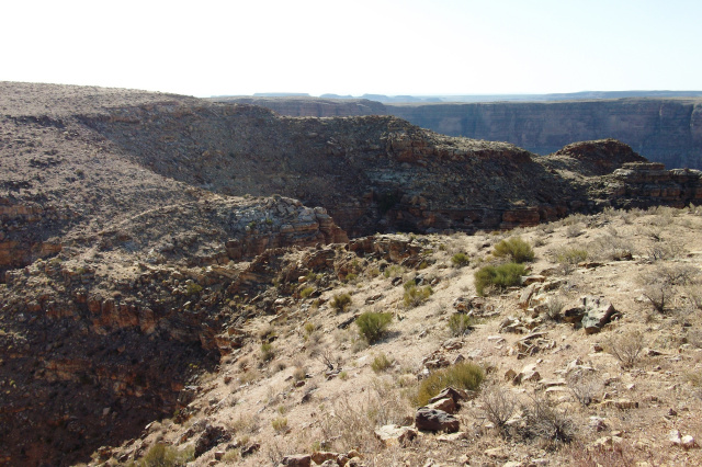
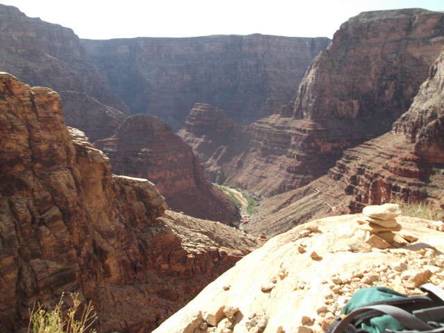
Unfortunately, that nice path only lasts about 50 yards, then it's straight down, 3000 feet to the bottom of the Little Colorado River Gorge, upriver from the great confluence with the Colorado River in the Grand Canyon.
After those first brief, innocent steps along the path at the top, this "route" (not a trail), drops quickly into the chasm. The first few rock cairns are easy to follow right down into the first big obstacle. 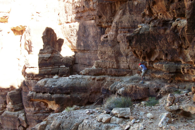
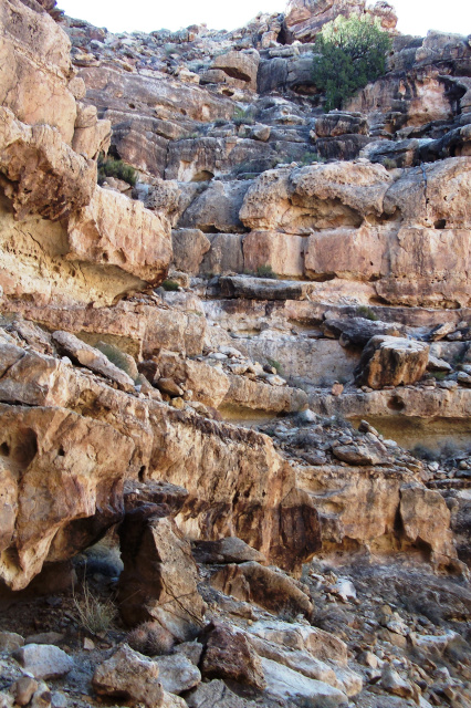
At this first major obstacle, follow the cairns to a pointed bridge-like rock structure sticking out of the wall. There should be a cairn on the point, but you don't have to go all the way out to the end. As you navigate your way around the point, hold on tight, step across the bridge and ease your way along the other side by holding on top and stretching your legs to the next foothold.
Once you've made it around the bridge and down a couple really steep drops on the other side, follow the cairns through the chasm. After carefully stepping down the gully/wash/drainage filled with loose rocks, you will be on very exposed ledges making your way to the next major obstacle. At this point, you're about half-way to the river, but may consider turning around when you come to this next, difficult move. We did, but forged ahead and were glad we made it.
 You'll know you've reached the next challenge when you see that the only way down is a ramp-like, rock feature that descends sharply, with a gap between it and the wall on your right. To maneuver down this safely, I went first, without my pack, leaning against the wall while supporting my legs with my feet pressed into the rock ramp. Then it was just kind of a chimney walk down to where I could take the packs and wait for my partner to do the same thing. We cheered after clearing that obstacle, only to realize there were several more challenges ahead. Oh, by the way, when lowering packs, be careful not to drop them into the crack between the ramp and the wall or they will fall down an irretrievable hole. Remember this spot, mark it with a cairn (there were none close by, but we figured it out) and know that it is easier on the way up for those in good shape who can lift themselves up the rock ramp.
After this freaky descent, make an immediate left into a rock gap that is just big enough for healthy humans to stand in and pass through. Hold your pack over your head, or pass it in front of you, or drag it along the top of the gap while slipping through the slot for about 6-10 feet. Once you are through this short gap, drop down into another little gap that leads to more cairns
From here, it's intense exposure, but nothing as technically or physically difficult as the previous move. Now, just start looking for the next cairn. Don't try to look more than 1 or 2 cairns ahead because objects may appear closer and less hazardous than they really are when you try to plan too far ahead. This is a good policy in life, I have found, also.
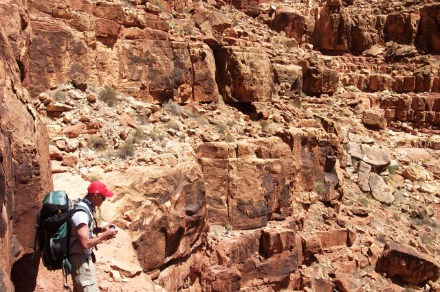 After that last adrenaline pumping move, we were hoping things would get much easier, but there were still plenty of sketchy, exposed areas to deal with and more route finding challenges. Our policy was to always follow the cairns, and that kept us from going to any dead end cliffs. However, we did have to look around and check things out more than once before descending further.
The next section features mostly tight switchbacks with plenty of loose rock to make for a slow go all the way down to the river. You don't want to slip now, so take it easy through here and you'll be bathing in the cool waters of Blue Springs soon enough.
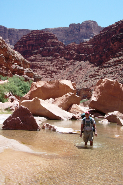 Also, the good news is that it took us almost 6 hours down, but only about 3-4 hours up because we knew the route (sort of). The cairns were easier to follow up, but still confusing in some spots. If you don't see the next cairn, go another way. The cairns are definitely there for a reason and are not misleading. You'll need to follow them all the way down to the muddy part of the river. Take extra water shoes, and tie your hiking boots to the pack once you hit the bottom. Then, avoid the quicksand down river to the Blue Springs.
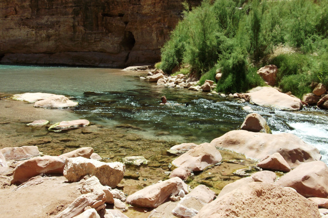
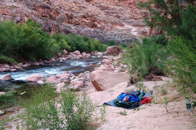 At Blue Springs, it's time for lovin' life. Although, rains can create muddy water, dry conditions mean beautiful blue spring water coming right out of the bottom of the wall of the Little Colorado Gorge. There's a real nice beach for a campsite, if no one else beats you to it. When we arrived, a younger group was about to vacate, hike up the Little Colorado River toward Cameron, spend the night at the bottom and hike out Waterhole Canyon the next day.
Waterhole Canyon is a much easier way down to the Little Colorado River than our Blue Springs route, but it includes 7 miles of slogging through the canyon mud, water and shrubs to reach our destination. Waterhole Canyon is also accessible only by a 20 mile dirt road, on the North side of the river, but is an easier one to drive than our Blue Springs access road.
Please note that this Grand Canyon, Blue Springs, Little Colorado River Gorge trip is only for experienced hikers, climbers, and drivers. The road in is almost as treacherous as the hike. Do everything else in the Grand Canyon National Park before attempting this one. Also, try South Canyon first as it is very exposed but much less dangerous or difficult than Blue Springs. If South Canyon is ok for you, then you're ready for this one.
Pros and Cons of this Grand Canyon, Little Colorado River, Blue Springs adventure:
Pros:
- Shortest route into one of the most beautiful spots in the Little Colorado River Gorge.
- Breathtaking scenery, especially at the bottom (with dry weather).
- Pretty, clear blue spring water right from the source (depending on previous rains).
- A nice beach to camp on.
- Adventure and plenty of challenges.
- Up is easier and faster than going down, believe it or not.
Cons:
- Far from rescue (the trail itself is at the end of a bad road, 19-20 miles from pavement).
- Mind-boggling, mood altering moves hanging onto rock that is basically falling apart while you are heavily exposed to serious, life-ending drops.
- Light pack required.
- Silty water from the Blue Spring that tastes funny and can be milky from recent rains, even after filtering.
- A couple real scary sections and less than foot-wide paths much of the way down with thousand foot drops right next to you.
Additional Notes: A preferred trip might be to hike down Blue Springs, float and hike down the Little Colorado River to the confluence where you can take the Beamer Trail to the Tanner Trail out of the Grand Canyon. This requires several days, but is an epic adventure at the Grand Canyon National Park and Little Colorado River Gorge.
This trip was inspired by Dock Ellis and made possible by Army Veteran David Cellitti (a great person with whom to celebrate Memorial Day by completing this adventure).
Colorado River rafting guides will tell you that the confluence is the "official beginning" of the Grand Canyon National Park boundary when heading down river on a rafting trip. This convergence of the Little Colorado River blue water and the typical green of the Colorado River come together for a show that is a highlight of any Grand Canyon rafting trip. Blue Spring is the source of that 70 degree blue water that hits the 40 degree Colorado River down from our destination on this Memorial Day weekend.